La Paz is a city whose parts rarely share the same level. Plazas and markets occupy the centre, brick neighbourhoods climb the slopes, and roads fold around the basin. Above them, Mi Teleférico crosses the city in long, quiet lines. From the cabin, the separate pieces finally sit in one geography.
That is why Mi Teleférico matters beyond the view. It is public transport, a practical way to connect parts of La Paz and El Alto, and one of the clearest introductions to the city’s physical shape. The street gives La Paz texture. The cable car gives it form.
The network belongs inside a day rather than beside it. During two days in La Paz, the traveller used the cabins between central streets, markets, museums and viewpoints. The rides were not a separate sightseeing excursion added after the city had been visited. They became part of how the city was visited.
For the wider sequence, continue to the three-day La Paz itinerary. For the broader set of places that make the city legible, see the best things to do in La Paz guide.
I. The city above the streets
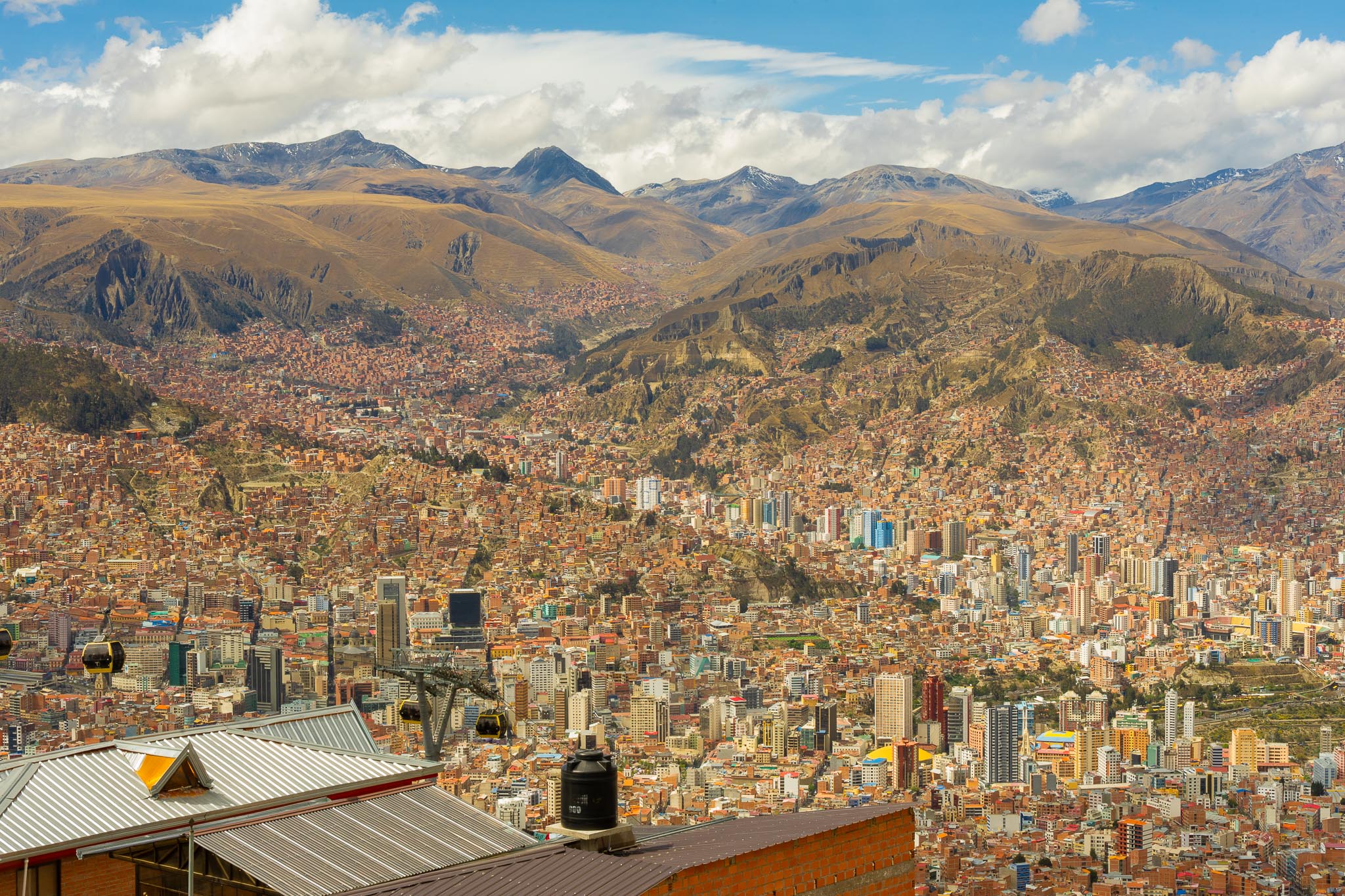
La Paz occupies a steep basin, with the high plateau of El Alto rising above it. Between the plateau and the lower city, neighbourhoods spread across slopes that make a short distance on a map feel much less simple on the ground. Roads have to follow the folds of the terrain, climb around the valley or funnel through the same busy corridors.
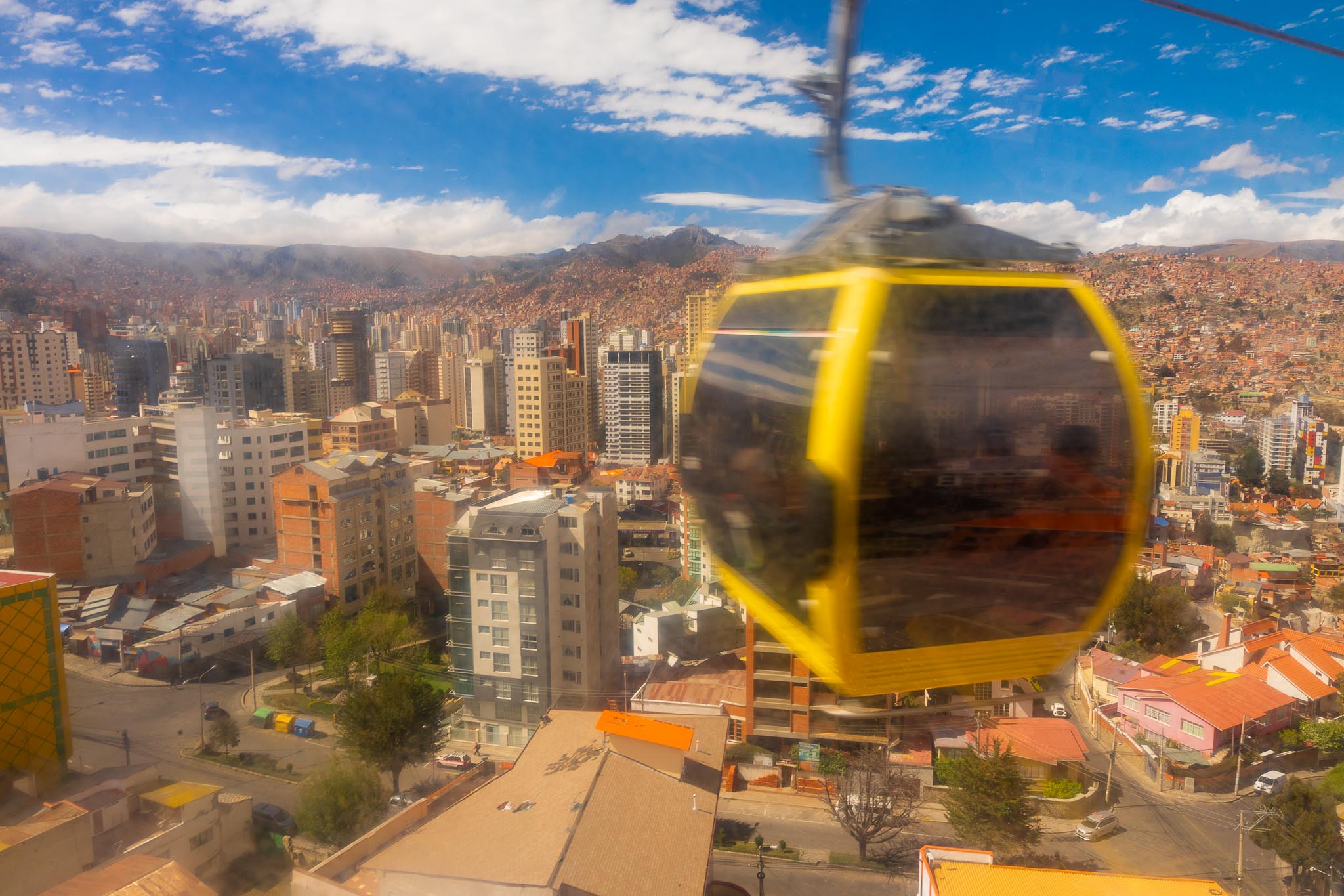
The cable car is an unusually direct answer to that shape. Its lines do not flatten the city; they expose the changes in elevation while moving across them. A cabin can leave the dense centre and pass above roofs, walls and roads before the next station appears on another slope. The journey is short enough to be useful and open enough to make the terrain impossible to ignore.
Mi Teleférico began operating in 2014 with the Red, Yellow and Green lines, then expanded into a wider urban network. Its purpose was never only to provide a high viewpoint. The system connects La Paz and El Alto and reaches across districts where the topography makes surface transport more complicated. New lines and interchange points have made the network part of the city’s wider public transport system rather than a single scenic route.
That context changes the way a visitor should use it. The cabins are not a novelty imposed on La Paz from outside. They are one of the city’s own answers to its steepness.
II. Why it works as public transport
The strongest ride is usually the one that takes the traveller somewhere useful. Mi Teleférico can connect a central walking day to a different district, reduce some of the road crossings between high and low parts of the city and turn a transfer into a chance to understand the terrain.
This is especially clear when the network is placed between ordinary stops. Plaza Murillo and the Witches’ Market belong to the street-level centre. Museums and San Francisco extend that central walk. Mercado Rodríguez brings the city back to everyday buying and selling. Mirador Killi Killi turns the basin into a single view. The cable cars sit between these experiences, joining them without becoming a separate loop that has to be completed for its own sake.
By the second day, the cabins had stopped feeling like an attraction and become part of how the traveller moved through La Paz. That is the practical argument for using them. One or two well-chosen journeys can show more of the city than a determined attempt to ride every line.
There is no need to build a first visit around a line-by-line inventory. The network is easier to appreciate when it remains connected to the city outside the stations: the short walk after getting off, the next market or museum, the streets that begin again below the cable.
III. What the traveller sees from above
At street level, La Paz arrives in fragments. A plaza gives way to a steep road. A market entrance opens into a compressed street. A museum doorway holds one part of the city’s history. Beyond a wall of houses, another slope rises and seems to close the view.
From a cabin, those fragments take their place in relation to one another. Roofs become a continuous surface. Roads reveal the contours they were following. Neighbourhoods that seemed separate at street level show how closely they occupy the same basin. Above the city, the distinction between centre, slope and plateau becomes easier to read.
The view is not a postcard version of La Paz. It is an urban section drawn in real time. The cabin passes over buildings and traffic; the valley opens, narrows and opens again. The mountains remain beyond the city, but the built slopes are the more immediate fact. La Paz is not simply set against a dramatic landscape. It has been built into difficult ground.
The traveller does not need to memorise every station for this to work. The useful knowledge is spatial: which direction the city rises, how El Alto sits above the basin, where the roads are forced to bend and why the cable network can cross territory that would otherwise take longer to negotiate.
IV. Using it across two days
Mi Teleférico fitted naturally into two different days. On the first, the traveller moved through Plaza Murillo and the Witches’ Market before taking the network above the centre and continuing towards Mirador Killi Killi. The order mattered because it moved from civic space to market street to infrastructure. The city changed register without the day having to change subject.
The following day returned to the cabins after the museums. By then, the view was no longer an introduction but a way to connect another part of the central route. The repetition made the system more useful. It showed that Mi Teleférico was not a single scenic ride but a form of movement that could sit naturally inside a longer day.
The best way to plan it is therefore to start with the places that matter at ground level and use the cable cars to join them. Pair a ride with Plaza Murillo, the markets, museums or a viewpoint. Leave time to walk after getting off. A station is a threshold, not the whole experience.
The La Paz markets guide is useful when the day is built around the Witches’ Market and Mercado Rodríguez. For a wider landscape excursion, the Valle de la Luna guide explains why that visit deserves its own block rather than being squeezed between central stops.
Transport or sightseeing?
Both, and that is what makes Mi Teleférico unusually valuable for a visitor. As transport, it joins districts across a city where elevation and road layout matter. As sightseeing, it makes the relationship between those districts visible. The two uses improve one another.
Treating it only as a viewpoint would make the experience feel staged. Treating it only as a transfer would miss the reason the network is so effective at explaining La Paz. The view is not an extra placed on top of the journey. It is a direct consequence of how the transport system has been built.
That dual role also keeps the day practical. A traveller can move between real destinations, then step out into another part of the city without having spent half a day circling the network. The ride earns its place because it does two jobs at once.
Is Mi Teleférico worth it?
Yes. Mi Teleférico is one of the essential La Paz experiences, not simply because the views are good but because the system makes the city’s physical structure understandable while participating in infrastructure La Paz actually uses.
It is worth using even when a particular line is not the day’s main objective. One or two journeys can be enough. The point is not to complete the map. It is to let the street-level city and the city above the roofs meet in the same visit.
How much time should you allow?
Build the rides into a central-city day rather than reserving a separate cable-car tour. Allow time to reach a station, travel, orient yourself after getting off and continue on foot. A first visit does not require every line or interchange.
Current fares, payment arrangements, operating hours and service conditions can change, so check the official Mi Teleférico information close to travel. The useful planning principle is stable: choose the journey that connects two places you genuinely want to see, then leave room for the city at either end.
Altitude still matters. The cable cars remove some steep road movement, but they do not remove the elevation. The traveller had already spent time at altitude before La Paz, and the plan favoured walking and cable cars over harder training. Keep the first climbs manageable and allow more time than the map alone suggests.
The city made legible
La Paz is still a street-level city. Its plazas, markets, museums and steep roads provide the detail that gives the place character. Mi Teleférico does not replace any of them. It places them in relation to one another.
Once the traveller has crossed above the roofs, the slopes stop feeling like a backdrop and become the organising fact of the place. El Alto, the basin, the climbing neighbourhoods and the roads below belong to one connected geography. The cable cars make that geography visible while carrying people through it.
The markets and plazas give La Paz texture. The cable cars give it shape. For the complete three-day route through the city, continue to the La Paz itinerary.
But the road is ever onward.